
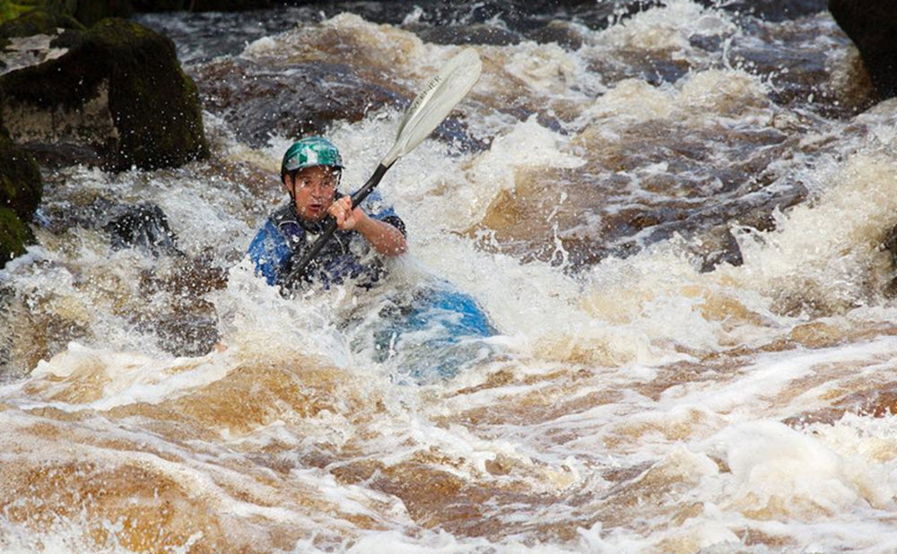
Whitewater kayaking in Galicia
My Galego land
where the sky is forever grey
where rain is art
and God laid down to rest
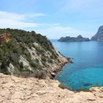
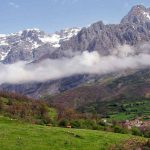
It was one of the songs I listened to whilst I drove to Galicia. And it is certainly true that rain is art in Galicia, a continuous and plentiful art. But few corners of the Iberian peninsula have the charm of Galicia. Its landscapes, forever green, plagued with eucalypts – imported trees which feed the paper pulp mills-, its beautiful villages and its coasts without equal definitely merit a visit. If we add to this the possibility of enjoying the best shellfish in the world or a good plate of “pulpo”, the famous local octopus, our visit becomes a real pleasure.
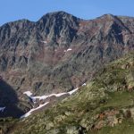
The charm of Galicia goes beyond its landscapes and its people when we come upon the network of rivers which criss-cross the countryside. It is no coincidence that the region has become a paradise for many European kayakers who flee their own cold climes in search of the moderate temperatures and gorged rivers which make Galicia a marvellous winter refuge.
A brief description follows of three great kayaking rivers: Miño, Lerez and Deza.
Miño
Put-in: Frieira reservoir dam.
Take-out: Barcela.
When we talk about the great rivers of the Iberian Peninsula the names that first come to mind are the Ebro, the Tajo or the Guadalquivir. Curiously we leave out the Miño, the river with the second-highest flow in the whole of the Peninsula.
From a kayaker’s point of view the Miño’s interest lies in the fact that it carries a lot of water over a low gradient and, overall, is not difficult. But with high water it can form wave trains, curlers and monster reversals. The water levels in this stretch are regulated by a dam so there are three levels which are practically constant: 25 m3/s, 125 m3/s and 225 m3/s. Exceptionally it can reach 325 m3/s. Difficulty levels vary therefore according to the water level – great reversals can appear in places where before there were only small waves, or strong rapids can disappear altogether.
It is important to keep away from the “pesqueras”, built by fishermen to catch lamprey or salmon and which coincide with or actually form rapids. The iron brackets used in their construction are sometimes completely exposed. It is also common for strong reversals to form on the sides of these “pesqueras”. The best and most fun way to run these rapids is to follow the main tongue of water, always well visible.
The river is perfectly navigable at all its water levels, although the most fun are those of 125 m3/s and 25 m3/s. With higher water some rapids disappear and strong reversals and whirlpools can give us a good fright if we end up swimming.
The whole stretch can take 4 to 6 hours, depending on water level and how much we want to paddle. But we can put-in or take-out at several points along the way: Frieira, Cequeliños, Arbo and Barcela.
There are some great spots on this river to play and to practice rodeo. Depending on water levels the best playgrounds are:
25 m3/s: Arbo curler.
125 m3/s: Arbo wave (site for the first rodeo championship in the Iberian peninsula).
200-300 m3/s: Under Frieira dam.
450 m3/s. Sunami waves between Frieira and Pousa (waves up to 5 metres).
500 m3/s. Wave between Oleiros and Salvatierra.
Lerez
It is one of the “big” Galician rivers, both in terms of beauty and because it retains high water even after the rains have ended – this is one of Galicia’s rainiest areas. Set in a attractive landscape with granite rocks and native riverside vegetation, as opposed to the rest of the valley which is invaded by eucalypts.
Vichocuntin bridge – Dorna hydroelectric plant. 8 km. IV-V (5+)
Put-in: Vichocuntin bridge
Take-out: Same as the next stretch
Without doubt it is one of the most spectacular stretches in all Galicia, combining high gradient with big volumes of water.
The gentle start hides what lies in wait after the first 4 km. After a small grade III rapid we reach a reservoir which channels away a large quantity of water which is only recovered at the end of this stretch, at the Dorna hydroelectric plant. We jump the dam on the left and from there on the river becomes more walled-in and we start to find rapids of some difficulty. We will come upon three falls, the first of about 3 metres and the second and third of about 8 metres. The last two channels before Dorna are possibly the most difficult in the river – long, steep, grade V rapids.
Dorna hydroelectric plant – Balneario de San Xusto, 4km, IV-IV+
Put-in: From San Xusto hermitage to Cercedo there is a track that goes down to the river. Careful, there is only room for two cars at the bottom!
Take-out: San Xusto hermitage and spa.
This is the classical Lerez route, due mainly to the fact that it usually carries more water than the higher portion of the river. The route goes from more to less, starting with channels that you can make by sight. Later the river stretches out into narrow granite gorges with two small ledges, the second with a backroller. From there on complications increase, the last channel before the last being the most difficult (you can see it from the parking lot at the hermitage). The rapids are noble and the water carries you through. Pay special attention if the top stretch carries a lot of water as the rapids here can become quite strong.
San Xusto spa – Bridge on road from Campo Lameiro to Cotobade.
A 5km beginner stretch. Only the first km. has grade III rapids.
Deza
A river of great beauty in a great natural setting. One of the main tributaries of the Ulla.
Carboeiro monastery – Merza hydroelectric plant, 6 km, III-IV
Put-in: Monasterio de Carboeiro. From the monastery car park take the thin path down to the river.
Take-out: Merza hydroelectric plant. To reach this small dam take the old bridge at the village and follow the track for about 2 km.
This stretch starts with few difficulties until you reach the dam at the picnic area in Careixa, about 2km further down. A good place to eat and bivouac. Don’t worry if water is low at this point as further down the river becomes narrower and the channels are easier. In any case the scenery is fantastic here and these first channels will serve as a gentle warm-up.
Now we come to beautiful grade IV slaloms between granite rocks and a steep channel worth checking out from the right shore. With a normal water level you can pass without difficulty through the centre. After a wide sweep to the right we see the Sulago bridge, and just before it we come onto the river’s strongest channel which we can see and check out from the right shore (IV+-V). Watch out for the tight bend and sharp flat rock to the right. The river then becomes calmer before the stretch ends with a 2-3 metre fall.
Note: This article appeared originally in Spanish in www.urkankayak.com.